|
|
Web Hosting by Netfirms | Free Domain Names by Netfirms |
|
|
Maps and Directions
|
|
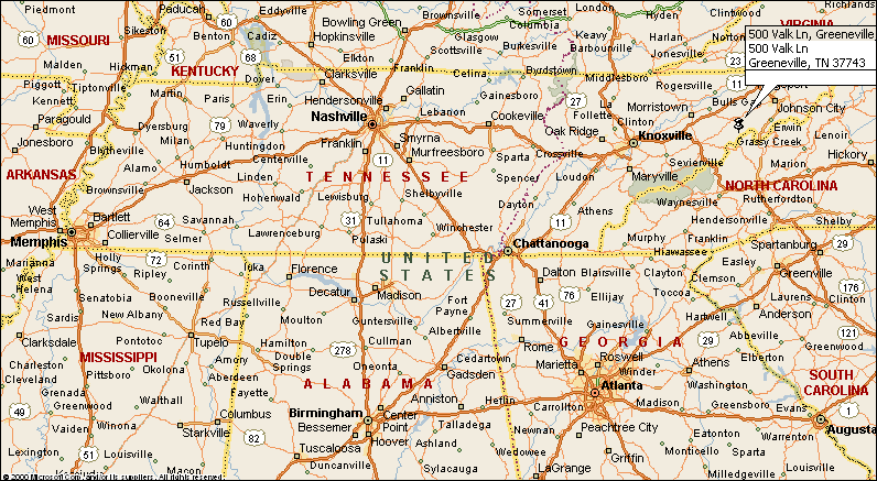
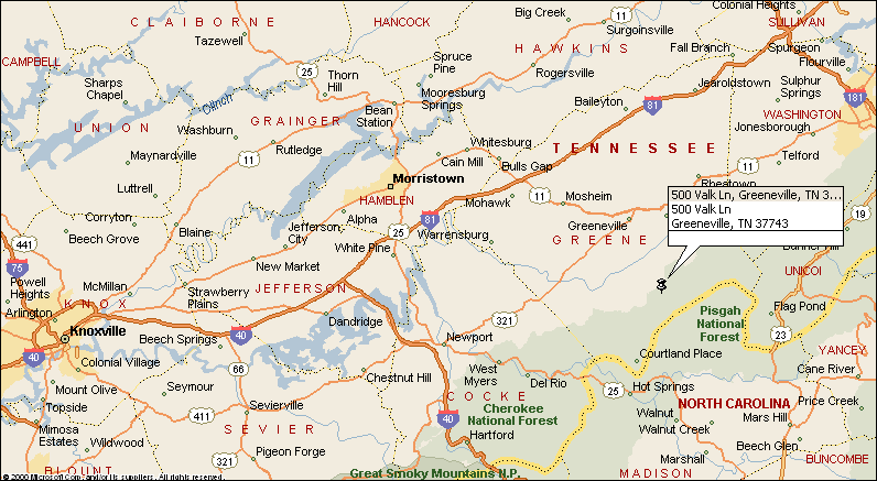
Our home is located in the Eastern part of Tennessee, bordering the Cherokee National Forest. The distance to the nearest Interstate Highway 81 (I 81) is about 21 miles (34 km). I81 intersects with I40, while I40 intersects with I75 in Knoxville, Tennessee. NOTE: In the USA all Interstate Highways running from east to west or west to east are always expressed in even numbers, hence north to south or south to north are odd numbers The nearest airport is "Tri City Airport" (TRI) about 45 miles (72 km), serving Bristol, Kingsport and Johnson City, however it is a far better choice to use Knoxville's airport "McGhee Tyson" (TYS) about 95 miles (153 km) from our home. This airport accommodates larger aircraft and is an excellent choice to use when flying into Atlanta, Georgia, for example, or other major airports.
|
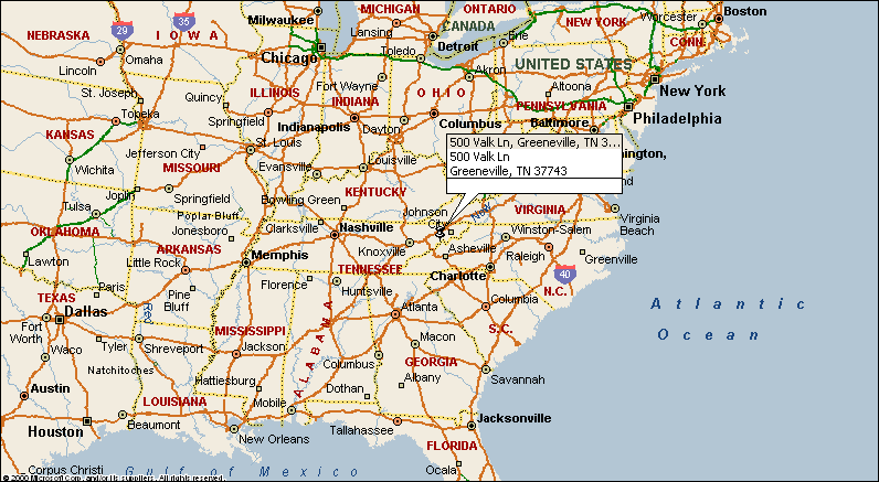 This map shows our location in the South Eastern part of the USA
|
|||||||||
This site was last updated 11/23/07